Instructions
Your First Steps
- Pan and Zoom to locate your Farm.
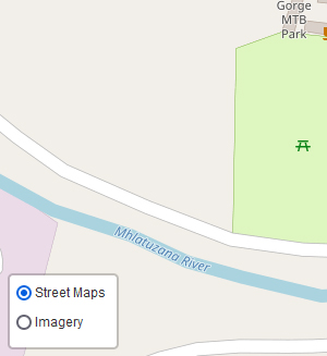
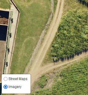
- Use the "Layer Control" at the bottom left to display satellite imagery or street maps
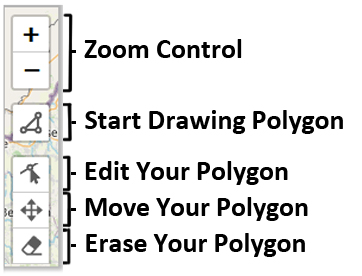
- Using the Polygon tool (
 - top left)
left-click start drawing your approximate boundary
- top left)
left-click start drawing your approximate boundary - Click on the first point to finish your polygon
- Click on the green "Submit" button in the top right (
 ) and fill in the form to submit your
farm boundary to our team.
) and fill in the form to submit your
farm boundary to our team.
- Click the
 button at the
bottom right of the screen for more information
button at the
bottom right of the screen for more information